

If you’ve ever struggled to find a house, a street or a small neighbourhood in Dubai, help is on the way. Street signs, area boards and house number plates across the emirate are getting a fresh look, with updated colours, one unified design and QR codes. The changes will reach 186 areas by 2030.
All of this is part of Dubai’s new addressing system, which aims to make it easier for residents, drivers and visitors to find streets, communities and individual properties.
What Is Changing Under the New Addressing System?
The Supreme Committee for Urban Planning is working with the Roads and Transport Authority (RTA) and Dubai Municipality to bring in one visual identity for the signs that mark communities, streets and properties.
Here’s what will change:
- Area identification signs: New designs for the signs that mark neighbourhoods and communities
- Internal street name signs: Updated signs showing street names inside residential and other areas
- House number plates: Redesigned plates with Makani numbers and QR codes
- QR codes on signs: Digital links with extra details about locations, street names and nearby attractions
Together, the signs will follow matching designs and colours, so the whole city feels more consistent.
Which Areas Get the New Signs First?
The first phase starts in 2026. More than 2,000 signs will be installed or replaced in five areas: Za’abeel 1, Za’abeel 2, Nad Al Sheba, Al Khawaneej 1 and Nazwa.
The wider rollout begins in the fourth quarter of 2026 and covers 186 areas across 19 sectors, with completion planned for 2030. Areas will be picked based on population density, urban growth, traffic, residential and tourist attractions, and how many streets still lack a formal address.
What Will the QR Codes Show?
Each new house plate will carry the property’s Makani number, Dubai’s unique 10 digit location code, along with a QR code.
QR codes on other signs will let people scan and learn about different sectors and communities, the meaning behind street and area names, and nearby landmarks. In later phases, the new look will also reach bus stops, smart apps and area map boards.
It’s a handy idea, and it matches how Dubai has been moving things onto our phones lately. You can see the same trend in how Dubai Metro, Tram and bus riders can now travel with just QR code tickets on their phones.
What Do Dubai’s Existing Road Sign Colours Mean?
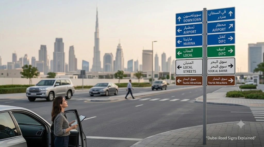
One thing to be clear about: this project covers area signs, internal street names and house plates. It doesn’t replace Dubai’s current colour coded highway signs. Those stay as they are, and each colour has its own job.
Blue signs mark inter emirate roads, known as E Routes, which link the emirates. They carry the UAE falcon emblem and appear on roads like Sheikh Zayed Road (E11) and Emirates Road (E611).
Green signs mark roads inside Dubai, called D Routes. They show Dubai’s castle emblem and help drivers move between different parts of the emirate.
White signs are the street name signs you’ll see inside residential communities. They name individual streets and internal roads, which helps residents, visitors and delivery drivers find exact addresses.
Brown signs point drivers to tourist spots, landmarks and places of interest, often with a symbol showing the type of attraction.
When Will It All Be Finished?
The project will roll out in phases until 2030, when the new designs should cover all 186 identified areas. For residents, the biggest changes will be more consistent street and community signs, updated house plates and QR codes that give quick access to extra location details.
Digital tools like this are becoming part of daily life in the city. If you’re curious how far that goes, take a look at how 9 out of 10 payments in Dubai are now cashless.
So the next time you can’t find a street, a scan of a QR code might soon be all it takes.